

Roads existed long before the first great empires, beginning as footpaths that connected farms, water sources, hunting grounds, and neighboring settlements. As kingdoms expanded, however, rulers needed routes that could carry soldiers, officials, messages, taxes, and supplies across territories that were becoming too large to manage through local relationships alone. Improving those paths turned transportation into a tool of government rather than a convenience for individual travelers. A dependable road could make a distant province feel much closer to the imperial capital.
The largest road systems were rarely created from nothing, since empires often expanded older trade routes and regional paths that local communities had used for generations. Imperial governments widened sections, constructed bridges, marked distances, established stations, and assigned workers to maintenance, creating networks that served military and administrative goals. Those same routes also allowed merchants, migrants, religious teachers, and ordinary travelers to move more widely. The evolution of roads and how they united empires reveals that infrastructure could connect diverse populations even when it was originally built to strengthen central power.
Early Empires Turned Paths Into Political Networks
The Achaemenid Persian Empire demonstrated how a long-distance road could help a ruler govern regions separated by enormous distances. The Royal Road connected major administrative centers across the western parts of the empire, while stations along the route supported official couriers and travelers. This system allowed the royal government to receive information and issue orders more quickly than ordinary travel would permit.
Roads also helped Persian officials oversee taxes, military obligations, legal matters, and provincial governors who operated far from the king’s court. A ruler didn’t need to be physically present in every region if representatives and written instructions could move reliably between the center and the provinces. Local roads joined larger imperial routes, creating layers of connection between villages, cities, and administrative capitals.
Other ancient states developed similar approaches as their territories grew. In South Asia, rulers improved established routes that connected population centers, commercial regions, and frontier areas, while Chinese dynasties built roads to strengthen communication and military movement across newly unified lands. These networks often followed practical geography, but rulers could also direct routes toward forts, capitals, and strategic borders.
Rome Expanded Road Building Into an Imperial System
Roman roads are famous partly because the empire developed such an extensive network across Europe, North Africa, and western Asia. Engineers adapted construction methods to local conditions, using drainage, foundations, bridges, cuttings, gravel, and paving where circumstances required them. Not every route had the same surface or impressive stonework, but major roads were designed to remain usable under heavy traffic.
The Roman military was one of the network’s greatest beneficiaries because soldiers and supplies could move along established routes instead of repeatedly finding paths across unfamiliar territory. Roads helped armies reach frontier zones, respond to revolts, reinforce vulnerable positions, and maintain contact with command centers. Milestones and official stopping places made long journeys easier to organize, while bridges reduced delays at rivers.
Civilian life also changed as the network encouraged the movement of merchants, craftspeople, administrators, religious groups, and private correspondence. Cities located on major roads could attract markets and services for travelers, while rural producers gained improved access to regional trading centers.
Roads Connected Difficult Landscapes and Diverse Populations
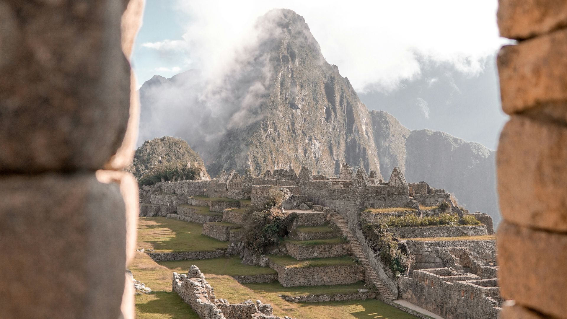
The Inca Empire created an enormous Andean road system across terrain that made transportation exceptionally demanding. Routes crossed mountains, valleys, deserts, and high plateaus, using stairways, retaining walls, drainage systems, and suspension bridges where necessary. Because wheeled vehicles weren’t central to Inca transportation, the network supported people on foot and caravans of llamas carrying goods.
Relay runners carried official messages along the routes, while way stations provided places to rest and obtain supplies. Storehouses positioned near the network held food, clothing, weapons, and other goods that could be redistributed by the state. Soldiers and administrators used the same system to reach distant communities and reinforce imperial authority.
Imperial roads also brought together populations with different languages, customs, economies, and local histories. Officials could collect information, communities could deliver required labor or goods, and state ceremonies could reach places far from the capital. At the same time, the network made conquest more effective, since the ability to move troops and resources strengthened the ruling power over newly incorporated regions.
The influence of imperial road systems often survived the governments that created or expanded them. Later rulers reused established routes because the most practical passages through mountains, river valleys, and populated regions didn’t disappear when political boundaries changed. Sections of Roman, Persian, Andean, South Asian, and Chinese networks continued to guide travel, trade, settlement, and later transportation projects. Their endurance shows that roads were more than construction achievements, because they shaped how people understood distance, authority, and connection across entire regions.
KEEP ON READING